
Season 1: New York City
The Ice and the People
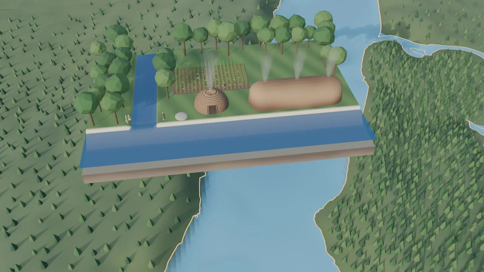
Summary
About 20,000 years ago a sheet of ice stopped on this coast. It piled up the two ridges that became Long Island, carried New Jersey stone onto Brooklyn, and filled a deep gorge in the rock so that Manhattan stayed one island. When the ice melted and the sea rose, the Lenape made a living from the harbor for at least a thousand years: nets across the stream mouths every spring, fields of corn, beans and squash tended by women, shell beads strung into wampum that served as money, and fires set each autumn to keep the meadows open for game. The episode ends with how the Lenape held land. It belonged to the whole village, families used it, and no leader could give it away forever. That idea of land is the first thread of the season’s business story.
Chapters
Then and now
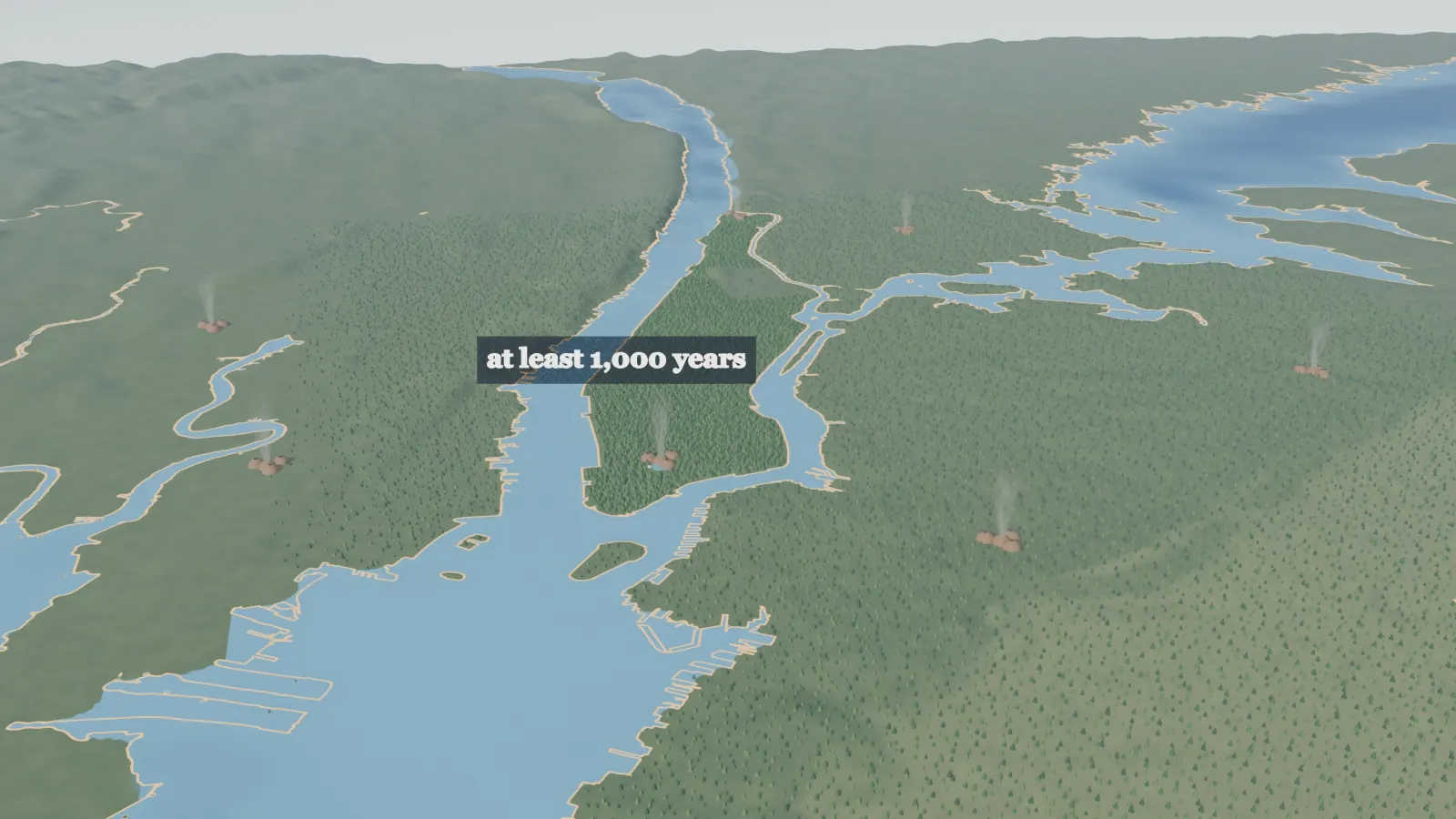
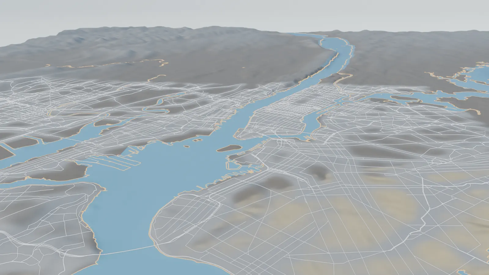
Animated reconstructions from the episode, built on elevation data and today's shoreline.
The map
Transcript
The full narration. Select a time to play from that moment. Each small number leads to the sources for that passage. Plain text version
The spring net 0:00
0:07In spring, people stretched a large net across the mouth of a stream, with stones weighting its lower edge. Spawning fish swam into it: alewives, shad and sturgeon. The catch was large, and it came every spring.1
0:23Women carried seed out to the field.2 The stream, the stones in the net and the field all had a history. The oldest part of that history was ice.
The ice makes the land 0:35
0:35About 20,000 years ago, the sea stood about 410 feet lower than it does today.3 A great sheet of ice came south and stopped on this coast.4 The ice was at least 500 feet thick, and at its edge it may have stood 1,000 feet high.5 It was heavy and slow. In places it slid over older ground without disturbing it.5
0:59Where the ice stopped, it dropped the rock and earth it had carried. The load piled up in two long ridges, one inside the other. Those ridges became Long Island, which runs east from New York Harbor.4 The inner ridge rises to 384 feet at its highest point.4
1:20Much of the stone under Brooklyn, now part of New York City, came from New Jersey. The ice had carried it across the river from the northwest, with many boulders.6 Melting water ran off the ridges at three points and spread sand over the land to the south. So the ground on the ridges was hilly and stony, and the ground south of them was flat and sandy.7
1:46The island of Manhattan is made of three kinds of rock, in a fixed order.8 The lowest forms the bluff along the east shore. Marble, a rock that water can dissolve, lies above it, standing almost exactly on edge. A river now called the Harlem River runs where it does because it follows that marble.8
2:07Schist, a coarse rock that is tough but not very hard, lies on top. A steep wall of schist runs down the west side for the whole length of the island.8 The island’s highest point stands about 265 feet above sea level.9
2:24A deep gorge in the rock crossed the upper part of the island. It started at the river on the island’s west side, now called the Hudson River, and ran east.10 Its floor lay almost 200 feet below sea level. The ice filled it with the loose earth and stone it carried. Much later, a drill at 125th Street, above the gorge, went down 204 feet and never reached rock.11
2:52Without that fill, the Hudson would meet Long Island Sound, the salt water to the east, across the island. Manhattan would be two islands. It is one island because the ice filled a hole.11
3:05As the ice melted, the sea rose again.3 Salt water spread into marshes where trees had grown not long before, and their stumps stood up out of the marsh.12 From then on, the Hudson ran in the flooded top of a much deeper valley. At New York City, the river’s rock floor lies about 300 feet down in places.13
A living from the harbor 3:28
3:28The people who lived along the lower Hudson were the Lenape.14 They had lived in their homeland for at least 1,000 years, and probably much longer.15
3:38Some of them spoke Munsee, one form of the Lenape language. They tended to call themselves by the names of their villages.1 Today their descendants are citizens of three nations, two in Oklahoma and one in Wisconsin.16 The people holding the net in that spring stream were Lenape.17
3:59Women grew most of the food.18 They grew mainly corn, beans and squash, and the corn was planted in open fields with few or no trees.19 Beside the corn stalks, they pushed beans into the ground. In the Netherlands, farmers grew beans up poles. Here the corn stalks were the poles.20 The women grew squash as well, and gathered nuts and berries in the woods.1
4:24The Lenape said that corn and beans had come to them from peoples to the south. Those peoples had got their seed from people farther south still. Before corn, they said, their own people had eaten roots and the bark of trees.21 Family descent ran through the women, and women were treated with considerable respect.1
4:46In summer, the men went to the river and caught a great quantity of fish in a short time.22 Every day, people dug mussels, clams and oysters from the beaches.1 They camped where fresh water met salt water. The best places had a spring for drinking and open water for fishing.23 Such places generally hold a heap of shells, mixed with ash, charcoal and stones cracked by fire.23
5:13Inland, Manhattan had a pond, the Fresh Water pond, with a large shell heap on its west shore.24 The Dutch would later name the spot after that heap. In time, the name was shortened to the Collect, and it passed to the whole pond.24 So a pond of fresh water ended up named after a trash heap.
5:36Near the water, people lived in lodges built on a frame of poles, arched over and set in the ground. Bark and mats of rushes covered the frame. From outside, the lodges looked “very much like wooden bowls turned upside down.” A fire burned in a pit in the floor, under a hole in the roof. Some lodges were as long as 60 feet and held several families.25
6:01Not every shell went on the heap. The harbor had large shellfish called cockles. People made beads from their shells, some white and some black.26 The beads were strung into belts called wampum. Wampum was highly valued, and it served as money.27 The Munsee name for Long Island meant land of shell money.28
6:23At Castle Hill, a point of land in the Bronx, one heap was different. It was made of the waste from making wampum.29
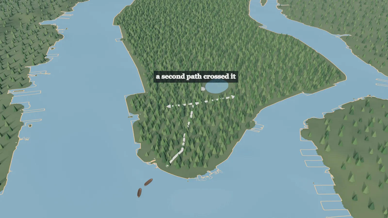
6:31Between these places, a main path ran north from rocks at the island’s southern tip, where canoes landed.30 Partway up the island, a second path crossed it, running west toward the Hudson and east toward the other shore.31 The city later built its hall where the two paths met. Many of the city’s later roads followed these old paths.31
6:56On the island’s west side, a cove called Sapohanikan sat on the Hudson shore. Canoes landed there with goods from the New Jersey side of the river.32 It was a trading place for the Hackensack, a people whose land lay across the river.33
Fire, the deer drive and winter 7:11
7:11As each year turned to autumn, the woods were burned over.34 The fires kept open the meadows that herds of game animals depended on.35 In that season, wild geese, turkeys and deer were at their best and easiest to take.36 The ground was still bare the next spring.34
7:29To take the deer, the hunters built two fences of stakes. At the open end, the fences stood one or two thousand paces apart. They ran closer together until the gap was only five feet wide, “like a large door.” The hunters drove the deer toward the gap, making a noise like wolves. They held deer hunting to be “the noblest hunting.”37
7:55A place called Shorakapkok lay far up the island, in the hollow now called Cold Spring, under Inwood Hill.38 Cold Spring had three rock shelters, out of the wind, with fresh water and both rivers close by. People left turkey and deer bones in them.39 A nearby path ran around the rocks. Feet had worn it more than an inch into the stone.40
8:19Close by, at a village site, people buried dogs, and sturgeon as well.38 The dogs’ bones were unbroken, so they had not been eaten. No one has given a satisfactory explanation.41
8:33Winter came. Where people spent it is an open question, with three possible answers.42 Families may have spent the summers in shore camps and the winters at the northern end of the island. The island may have been only a place to work, used from villages on the mainland. Or it may have had a main village of its own.42
Land held by use 8:55
8:55Wherever they wintered, land belonged to the whole village. The village gave a piece of it to a family to use. When needed, it could give that piece to another clan.1 Three peoples lived together on Staten Island, another island in the harbor, and two more had rights there too.43
9:13In the same way, a village leader had to persuade people to follow him, because he could not force them. The villagers could reject his decisions, or reverse them later.1 A war leader gave orders in war. When the fight ended, so did his power.44
9:32Even a field, when it was left alone, grew back into woods. The Lenape said of one stand of young woods that they had planted corn there only twenty years before.45 To the Lenape, goods given for land may have looked like no more than a customary exchange of friendly gifts.46 Land seems to have been held through use, and no leader could bind a village to give it away forever.47
How We Know
Every line of this episode rests on a source. The episode draws on 18 works, listed here by kind, and the notes after them show which source supports each passage of the transcript, with page numbers where the source has them. Where the sources fall silent, the animation makes a setting choice and labels it on screen.
Primary sources
Records written at the time, and a Lenape tradition written down by a missionary.
- J. Franklin Jameson, ed., Narratives of New Netherland, 1609 to 1664 (1909), for Wassenaer and the Representation of New Netherland. Read a free copy: Jameson 1909
Supports 8 passages in the transcript. - Adriaen van der Donck, A Description of the New Netherlands, trans. Jeremiah Johnson (1841). Read a free copy: Van der Donck
Supports 5 passages in the transcript.
Scholarship and science
Later histories, field studies and geological surveys.
- Myron L. Fuller, The Geology of Long Island, New York, USGS Professional Paper 82 (1914). Read a free copy: Fuller 1914
Supports 9 passages in the transcript. - Reginald Pelham Bolton, New York City in Indian Possession (1920). Read a free copy: Bolton 1920
Supports 9 passages in the transcript. - Alanson Skinner, The Indians of Manhattan Island and Vicinity, American Museum of Natural History (1915). Read a free copy: Skinner 1915
Supports 8 passages in the transcript. - Charles P. Berkey, Geology of the New York City (Catskill) Aqueduct, New York State Museum Bulletin 146 (1911). Read a free copy: Berkey 1911
Supports 6 passages in the transcript. - L. P. Gratacap, Geology of the City of New York, 3rd ed. (1909). Read a free copy: Gratacap 1909
Supports 6 passages in the transcript. - Arthur C. Parker, The Archeological History of New York (1920).
Supports 3 passages in the transcript. - Poore, Williams and Tracey, “Sea Level and Climate,” United States Geological Survey Fact Sheet 002-00 (2000, revised 2011). Read a free copy: USGS, Sea Level and Climate
Supports 2 passages in the transcript. - E. M. Ruttenber, History of the Indian Tribes of Hudson’s River (1872). Read a free copy: Ruttenber 1872
Supports 2 passages in the transcript. - Reginald Pelham Bolton, Indian Paths in the Great Metropolis (1922). Read a free copy: Bolton 1922
Supports 2 passages in the transcript.
Reference and public institutions
Public agencies, museums, Lenape institutions and reference works.
- National Park Service, The Lenape. Read the page: National Park Service, The Lenape
Supports 15 passages in the transcript. - Wikipedia, “Hudson River”. Read the page: Wikipedia, Hudson River
Supports 3 passages in the transcript. - The Mannahatta Project, Wildlife Conservation Society. Read the page: The Mannahatta Project
Supports 2 passages in the transcript. - Wikipedia, “The Narrows”. Read the page: Wikipedia, The Narrows
Supports 1 passage in the transcript. - National Park Service, Gateway National Recreation Area, “Fort Wadsworth”. Read the page: National Park Service, Fort Wadsworth
Supports 1 passage in the transcript. - NYC Parks, Bennett Park. Read the page: NYC Parks, Bennett Park
Supports 1 passage in the transcript. - The Lenape Center. Read the page: The Lenape Center
Supports 1 passage in the transcript.
Notes: which source supports each passage (47)
- National Park Service, The Lenape a b c d e f g
- Jameson 1909 (Wassenaer), p. 69 ↩
- USGS, Sea Level and Climate a b
- Fuller 1914, pp. 163 and 168 a b c
- Fuller 1914, p. 210 a b
- Fuller 1914, pp. 169 to 170; Wikipedia, The Narrows; National Park Service, Fort Wadsworth ↩
- Fuller 1914, p. 173 ↩
- Berkey 1911, pp. 48 to 49 and p. 238 a b c
- NYC Parks, Bennett Park ↩
- Berkey 1911, p. 244; Wikipedia, Hudson River ↩
- Berkey 1911, p. 244 a b
- Fuller 1914, pp. 213 to 215 ↩
- Fuller 1914, pp. 61 to 62 ↩
- Wikipedia, Hudson River ↩
- Parker 1920, pp. 39 to 40; The Mannahatta Project; National Park Service, The Lenape ↩
- The Lenape Center ↩
- National Park Service, The Lenape; Wikipedia, Hudson River ↩
- Jameson 1909 (Wassenaer), p. 69; National Park Service, The Lenape ↩
- National Park Service, The Lenape; Jameson 1909 (the Representation of New Netherland), p. 294 ↩
- Jameson 1909, p. 219 ↩
- Van der Donck, pp. 3 to 4 ↩
- Jameson 1909 (Wassenaer), p. 71 ↩
- Skinner 1915, p. 13 a b
- Skinner 1915, p. 44 a b
- National Park Service, The Lenape; Skinner 1915, pp. 10 to 11 ↩
- Jameson 1909 (the Representation of New Netherland), p. 298 ↩
- National Park Service, The Lenape; Gratacap 1909, pp. 229 to 230 ↩
- Gratacap 1909, pp. 229 to 230 ↩
- Bolton 1920, pp. 303 to 304 ↩
- Bolton 1920, pp. 302 to 303; Gratacap 1909, p. 229 ↩
- Gratacap 1909, p. 229 a b
- Bolton 1920, pp. 302 to 303 ↩
- Bolton 1920, pp. 239 to 240 ↩
- Van der Donck, pp. 19 and 21 a b
- National Park Service, The Lenape; The Mannahatta Project ↩
- Van der Donck, p. 21 ↩
- Jameson 1909, p. 220 ↩
- Bolton 1920, pp. 306 to 308 a b
- Skinner 1915, pp. 45 to 46 ↩
- Parker 1920, Part 2, p. 630 ↩
- Parker 1920, Part 2, p. 629 ↩
- Skinner 1915, p. 45; Ruttenber 1872, pp. 77 to 78; Bolton 1922, p. 43 a b
- Bolton 1920, pp. 231, 238 and 240; Gratacap 1909, pp. 229 to 230 ↩
- Jameson 1909 (Wassenaer), pp. 69 to 70 ↩
- Van der Donck, p. 149 ↩
- Bolton 1920, pp. 231, 238 and 240 ↩
- Bolton 1920, pp. 231, 238 and 240; National Park Service, The Lenape ↩